How to build a GPS app: 4 steps to creating, examples, technologies
Applications with GPS have recently gained increased popularity. The usage of this feature allows developers to broaden the possibilities of their software. Many location-based features have already been created for sports apps, shops, live-streaming apps, and a lot of others.
We shall cover how to create a location-based app and how it can be used.
4 steps to creating a GPS app
To make things easy, we have prepared a simple step-by-step guide that shows how a location-based application can be made.

We are confident that we have what it takes to help you get your platform from the idea throughout design and development phases, all the way to successful deployment in a production environment!
1. Research the market
It is necessary that you analyze the software of your competitors and market demand thoroughly. This will let you get a better idea of how your software should be developed.
Try creating software that is more powerful than the applications offered by other developers.
2. Make a dummy-model or wireframe of the project
Turning ideas into real apps is much easier when you write them on paper. When this is done, you get a better idea of how things will turn out and what else you can add. Moreover, this simplifies the future development process because you can create something like a mindmap.
3. Create the MVP of your project
The creation of the MVP for your app will let you estimate whether it functions just the way you want. Also, you can get some reviews from testers to see if the core features work as intended.
4. Add the nice-to-have features
Once you get several user reviews and complete the development of the core features, it is time to add advanced options. Think of everything you’d like to add to the software to make it stand out from the crowd.
What applications use GPS technologies?
To understand what types of software you can create, it is best if you check out the examples of others that use GPS technologies.
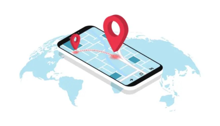
Maps, navigation apps
Have you ever used Google Maps? Similar software is used to assist people in terrain navigation. As long as the app is built properly, you may rest assured that you won’t get lost!
Recommendations
When you want to visit a store, cafe, or sports gym, the first thing you do is check the reviews on the web. GPS applications help users view this information along with a lot of other details for any business placed on a map.
Geosocial apps
Sharing photographs and videos while tagging a specific location also involves GPS locations. Similar features are available in most social media apps like Instagram and Facebook.
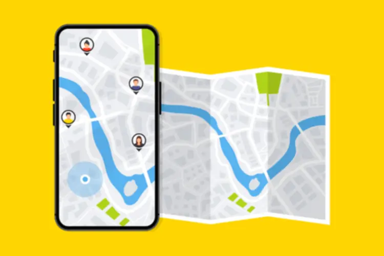
GPS tracking and fitness applications
Software that tracks your location is usually used for sports or security. For instance, you can track your running route to view the distance passed or make sure your child does not leave a specific area.
Weather forecasts
When you want to check a weather forecast, it is likely that you need to know about a specific location. Special software sees where you are currently located, so it automatically shows the most appropriate results.
Dating apps
There are many programs that are created for people who want to find a friend, partner, etc. A prominent example is Tinder. It uses your location to find a suitable match or show everyone who has posted a profile in a specific area.
Events apps
Eventbrite is a great example of event apps. These are very similar to social media, but they are related to a specific event where users and hosts get related information ASAP.
Traveling software
TripAdvisor is the most prominent example of traveling software. Such applications can be used to book hotels, buy transport tickets, view the best local deals, etc.
E-commerce software
When you use a shopping application, it adapts the deals to your current location and shows the closest local shopping facility. Also, the pricing may differ.
Games
Remember Pokémon Go? Many similar games have been developed since the release of this one. The point is that such apps use your location for gamification, create a brighter experience, and connect reality and fantasy.
What technologies are required to build a GPS app?
Speaking from a general point of view, we need two things to build a functional GPS app:
- A location service
- Online maps.
If we look from a broader perspective, then we’ll cover 5 technologies that can be used.
GPS
This technology is available in every modern smartphone.
To determine one’s position properly, at least 4 satellites are required. While the accuracy is not 100% correct, you will get information with up to 60 feet difference. How does this work?
- Radio signals are sent from each satellite. They cover their location, time, status, and other information.
- The speed of the signal is the same as the speed of light (that is very fast).
- Your device receives the signal with all the information and calculates how far each accessible satellite is.
GPS should be available around the whole globe at any time regardless of your position.
Cell ID
Sometimes, it may occur that GPS does not work in a certain area. In this case, it is possible to use the signal from cell towers. They help to determine the position of the device without using satellites.
A-GPS
A-GPS is a combination of the two previous technologies. It is much more precise than the two separately, so it is great to use when exact data is required.
Wi-Fi
Wi-Fi acts as an improved version of a cell tower. Its main advantage is that it covers a very small area and that is why the calculations are so precise. There are two options with which you can determine someone’s location via Wi-Fi:
- RSSI
This option measures the signal strength to decide how far a user is.
- Wireless fingerprints
This option covers the places that are often visited by users. Their accuracy is 2 meters.
Putting the current location on a map is possible through the usage of a Map Kit Framework or anything similar.
What is Geofencing?
With the help of Geofencing, it is possible to understand whether a user is inside or outside a specific store, building, location. This information can be used to show targeted advertisements and monitor the number of people in an area.
Geofencing types
There are 3 types of geofencing you should be aware of.
- Static triggers
In this case, customers may receive a notification right after entering a location.
- Dynamic triggers
Supposing you are currently passing near a parking lot. If it uses dynamic triggers, you will get a notification that something happened: a parking space became free, it is time to pay for space, etc.
- Combination
In this case, social engineering takes place. You get notified about the check-ins of your friends and other similar occasions.
What are iBeacon and Eddystone?
With the help of these two technologies (one for iOS, another for Android), it is possible to share identifiers to trigger a number of specific actions within the software that was specially designed for them.
All these options do is identify whether the target device is located within a specific area where the technologies work. They can navigate a visitor in a store and help find a specific product.
Does your application need GPS?
Now that you know about some of the existing technologies and their purposes, it is time to figure out whether your software needs anything of the kind. Ask yourself the following questions:
- How will GPS assist the end-user?
- Is GPS a must-have feature for this app?
- Why does the app need GPS?
Once you are able to answer all three questions, you will be ready to create a high-quality application that won’t be just another copy on the market. Create something that is better than the existing alternatives!
Development costs for a GPS app
The creation of a good GPS app requires the work of a skillful team of developers.
Giving an estimate is very hard. Remember that the final price depends on your requirements regarding functionality and other details. Moreover, do not forget about marketing expenses.
In general, the cost of developing a GPS app ranges from $10,000 to $100,000. It is best if you ask your team to calculate an approximate price range in advance. This will help you adapt the budget properly.
The bottom line
Now that you know about how to build a GPS app, the technologies, examples, and price ranges, it is time to create software of your own. Contact the GlobalCloudTeam to hire a team of professionals now!

Total Articles: 211
Top Articles

Container vs VM (Virtual Machines): How Do They Differ?


I am here to help you!
Explore the possibility to hire a dedicated R&D team that helps your company to scale product development.